Catalog Archive
Auction 137, Lot 424

A Stunning Map of the Gulf of Mexico

"Carte d'une Partie de l'Amerique pour la Navigation des Isles et du Golfe du Mexique…", Buache, Philip

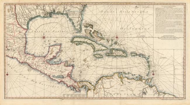
Subject: Gulf of Mexico and Caribbean

Period: 1740 (dated)

Publication:

Color: Hand Color

Size:
36.3 x 19.3 inches
92.2 x 49 cm
Download High Resolution Image
(or just click on image to launch the Zoom viewer)

This is a very scarce chart of the Gulf of Mexico drawn from Popple's important map of the British Empire in America with "corrections and augmentations" as noted by Buache in the French text at upper right. The chart is focused on navigational information, with soundings, shoals, currents, etc. carefully noted. It extends to include much information on the interior of northern South America, Central America, and the southern U.S. On two sheets joined.

References: Lowery p. 278, #358.

Condition: A

There are a few small fold separations, light offsetting, and some stains in blank margins.

Estimate: $1,600 - $2,000

Unsold

Closed on 9/14/2011

Archived