Catalog Archive
Auction 137, Lot 421

A Magnificent Sea Chart of the West Indies

"Indiarum Occidentalium Tractus Littorales cum Insulis Caribicis ... / Pascaert van Westindien ende Caribise Eylanden…", Wit, Frederick de

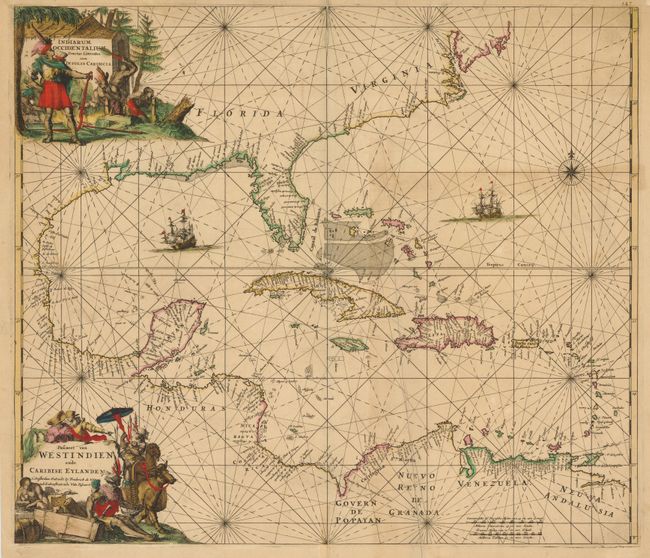
Subject: Gulf of Mexico and Caribbean

Period: 1680 (circa)

Publication: Orbis Maritimus ofte Zee Atlas

Color: Hand Color

Size:
22.2 x 19.2 inches
56.4 x 48.8 cm
Download High Resolution Image
(or just click on image to launch the Zoom viewer)

This is the scarce first edition of one of the most beautifully engraved maps of the West Indies. It extends to show the coastline of North America nearly to New England, all of Central America, and the northern coastline of South America. There is a wealth of navigational information including passages, anchorages, sandbanks and shoals. The chart is a masterpiece of decorative engraving with illustrations of sailing vessels, a compass rose and two elaborate title cartouches (Latin and Dutch), one showing cannibalism.

References: Burden #468.

Condition: B

Old color with short centerfold separations at top and bottom and three tears at top that enter map image 1-1.5", all of which have been repaired with old paper on verso. There is also a long vertical crease to the right of centerfold and light toning.

Estimate: $2,400 - $2,750

Sold for: $1,350

Closed on 9/14/2011

Archived