Subject: Caribbean and Mexico
Period: 1580 (published)
Publication: Theatrum Orbis Terrarum
Color: Hand Color
Size:
19.6 x 14 inches
49.8 x 35.6 cm
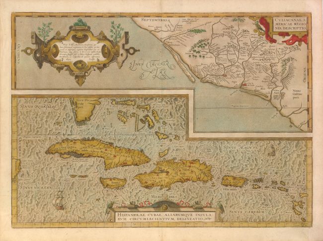
Two great early maps of important regions in the New World are combined into this interesting composition. The first covers the region of western Mexico around Culiacan and the Spanish settlement of Villa S. Michael's, the region noted for its silver mines. The second is the first detailed map of the Antilles with detail in southern Florida, the Bahamas, and the Caribbean that is quite remarkable for the period. Ortelius based the maps on a variety of sources including Mercator’s world map (1569) and other maps by Gutters and Alonso de Santa Cruz. This is the first state that includes an interesting error; the Tropic of Capricorn is shown where the Tropic of Cancer should be. Three strapwork cartouches and sailing ships decorate the map. German text on verso.
References: Van den Broecke #14.
Condition: C+
Old color on watermarked paper with a 1.5" and a 0.5" tear in map image at left.