Subject: Virginia
Period: 1855 (dated)
Publication:
Color: Black & White
Size:
30 x 25.5 inches
76.2 x 64.8 cm
The Office of Coast Survey is the oldest U.S. scientific organization, dating from 1807 when Congress directed that a "survey of the coast" be carried out. By 1836, it was called the U.S. Coast Survey and in 1878, the name was changed to the U.S. Coast and Geodetic Survey. Today the Office of Coast Survey is a division of the National Oceanic and Atmospheric Administration NOAA.
The survey teams, composed of civilians as well as Army and Naval officers, charted the nation's waterways and produced a wide array of reports, survey charts, hydrographic studies of tides and currents, astronomical studies and observations, and coastal pilots. These charts are an important record of the changing nature of the nation's coastlines. In additional to coastal charts, the U.S. Coast and Geodetic Survey produced land sketches, Civil War battle maps, and the early aeronautical charts.
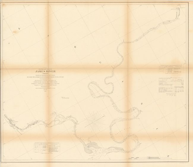
Richmond, on the fall line of the James River, is shown at the upper right. Petersburg, on the fall line of the Appomattox River, is shown at the lower left. City Point, where the rivers meet, is shown near the bottom center. All three cities were important inland sea ports before the Civil War.
References:
Condition: B
There is some toning along the folds and one small spot in upper left portion of image. Backed with Japanese tissue. Issued folded and now flat.