Subject: South Carolina
Period: 1860 (circa)
Publication: The American State Papers
Color: Hand Color
Size:
18.7 x 14.6 inches
47.5 x 37.1 cm
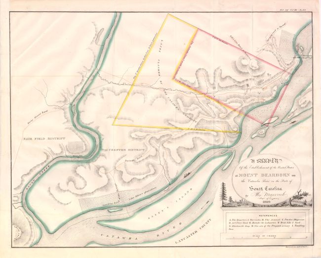
This map outlines a land dispute between the United States and the Catawba Indian Tribe. In 1763, the King of England guaranteed 144,000 acres of land to the Catawba Indians in South Carolina through the Treaty of Fort Augusta. Over the next 80 years, the Catawba Tribe leased almost all of their land to non-Indians. Centered on the intersection of Fairfield, Chester and Lancaster counties, the map shows a small rectangular tract of land possessed by the United States containing barracks, an arsenal, a blacksmith shop, and other buildings. An adjacent tract of land is in contention, being possessed by the U.S., but also claimed by the Catawba. This fascinating map also depicts roads, portages, plantations, two boats traveling the river, and a lovely vignette of a town below the title cartouche.
References:
Condition: A
Folding, as issued with original outline color. A few short tears in blank margins closed on verso with archival materials, and some faint offsetting.