Subject: South Carolina
Period: 1825 (dated)
Publication: Atlas von Amerika
Color: Hand Color
Size:
14.5 x 12.8 inches
36.8 x 32.5 cm
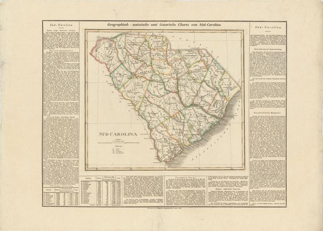
This attractive map, based on the important first official map of South Carolina by John Wilson in 1822, provides a detailed view of the counties, roads, and settlements. This map is surrounded by German text describing the great state (22.2 x 17"), with the title above "Geographisch - statistische und historische Charte von Sud-Carolina." Similar to Carey & Lea's map of South Carolina from their Atlas of North America, this rare German edition was re-engraved by the Weimar Geographischen Insitut for Weiland's Atlas, and is one of the earliest maps of the state printed outside the U.S.
References:
Condition: B
Wide margins with a short centerfold separation at bottom in blank margin and a 1/2" horizontal tear in Lexington county that is visible only when held up to light.