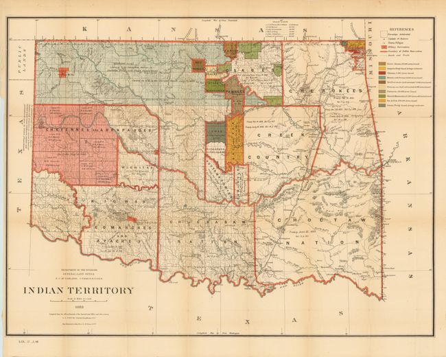
Subject: Oklahoma
Period: 1883 (dated)
Publication: Senate Doc #17, 48th Congress, 2nd Session
Color: Printed Color
Size:
32 x 24 inches
81.3 x 61 cm
This detailed and informative map shows the locations of tribal Indian lands, color-coded to illustrate the status of leased lands. Indian removals from their homelands began as early as 1817 and in the following years many of the principal eastern Indian tribes were relocated to the Indian Territory, forming the Five Civilized Tribes. The map reflects the additional settlement of many more tribes in the territory and provides some data on the pertinent treaties involved. Of particular interest is the Cherokee Strip, noting that its six million acres were leased to the Cherokee Live Stock Association [no date] and ceded to the U.S. by the Cherokee nation in 1866. The map does not include the panhandle, which by this time is Public Lands. Drawn by G. P. Strum, principle draughtsman for the G.L.O.
References:
Condition: B
Nice colorful image with a few fold separations and a hint of light toning. Issued folding with the left, binding side margin narrow. There is a short insertion tear in the upper left margin just entering the neatline.