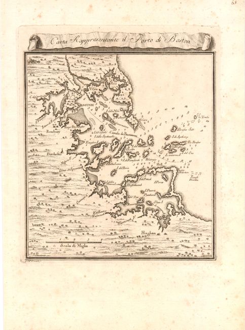
Subject: Boston, Massachusetts
Period: 1757 (published)
Publication:
Color: Black & White
Size:
7 x 7.5 inches
17.8 x 19.1 cm
This scarce Italian-produced map showing the vicinity of Boston Harbor is engraved in typical beautiful Italian style with dark, bold lines. Boston is in the northern third of the map that extends south to include Hingham. The map locates Roxbury, Dorchester, and Cambridge. Coastal towns, harbor features and islands are well mapped and recognizable. Dozens of soundings and the main ship channel are clearly shown. The decorative script title is contained in a scroll banner that floats above the map. A most uncommon issue that was issued during the French and Indian War.
References:
Condition: B+
Nice strong impression with some scattered foxing primarily in the blank margins, else very good.