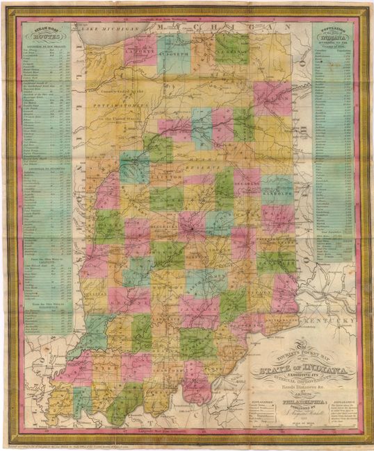
Subject: Indiana
Period: 1835 (dated)
Publication:
Color: Hand Color
Size:
12.5 x 15.3 inches
31.8 x 38.9 cm
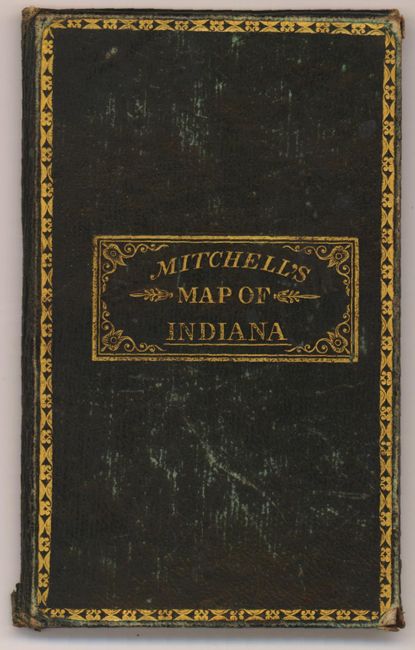
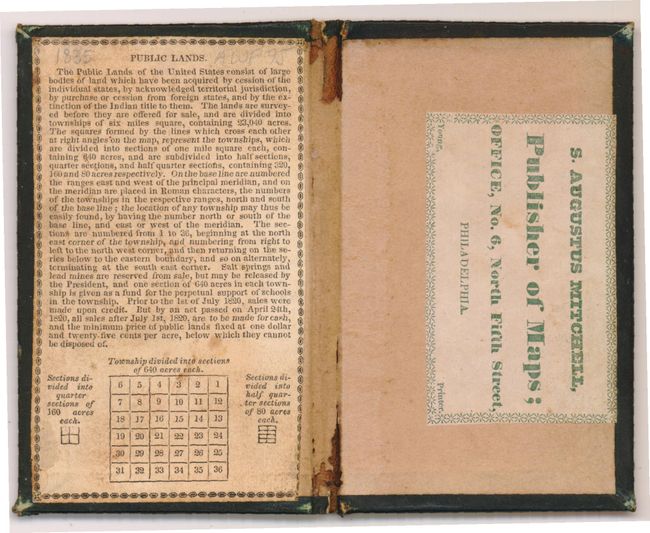
This is a steel engraved pocket map of the state with 63 hand colored counties. The map features information intended for the traveler, with roads, railroads and canals noted. The National Road is prominently displayed and mileages are displayed between routes on the principal roads. Also noted is the "Country Ceded by the Pottawatomies" and the "Miami Reserve" and shows little development in the northwestern part of the state. Included are two tables - at left is a listing of steamboat routes and distances, and at right is the state's population by county as of the 1830 census. The map is printed on thin bank note paper and folds into green tooled and gilt covers with original Mitchell "Publisher of Maps" paper label on back paste down.
References:
Condition: B+
A nice example with a few tiny splits at the fold intersections that have been repaired with archival tape on verso. There is a tiny hole in the steamboat table that does not distract and a few minor spots. The map is issued folded and is separated from the covers.