Catalog Archive
Auction 137, Lot 279

Interesting French map of the California Gold Regions

"Carte de Californie d'Apres les Documents Connus en 1862. Relation d'Un Voyage aux Mines de Californie Par M.P. Laur Ingenieur des Mines",
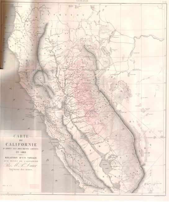
Subject: California

Period: 1862 (dated)

Publication: Annales des Mines ou Recueil…

Color: Printed Color

Size:
17.5 x 20 inches
44.5 x 50.8 cm
Download High Resolution Image
(or just click on image to launch the Zoom viewer)

First edition of this map by French mining engineer M. P. Laur showing the Gold Regions in California. The map shows the state from Crescent City to St Luis Obispo. The Gold Regions are printed in red hachure. The cartography seems to come from a couple different sources, but is based primarily on Fremont's map of the region. Map bound and folded into the complete report, Annales Des Mines ou Recueil, dated 1863. New paper covers, 88pp with a folding map and 4 additional geologic plates.

References:

Condition: A

Map is in very good condition. There is a small tear just extending beyond the neatline at the binding trim and some faint offsetting. New covers with contents clean and tight.

Estimate: $400 - $550

Sold for: $300

Closed on 9/14/2011

Archived