Catalog Archive
Auction 137, Lot 127

"Carte Qui Represente Les Differentes Connoissances Que l'on a Eues des Terres Arctiques Depuis 1650 Jusqu'en 1747 Ausquelles il Faut Comparer La Carte Suivante", Robert de Vaugondy
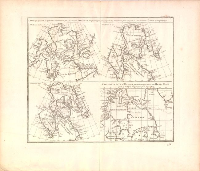
Subject: Canada

Period: 1773 (dated)

Publication: Diderot's Encyclopedie (Supplement)

Color: Black & White

Size:
13.5 x 11.5 inches
34.3 x 29.2 cm
Download High Resolution Image
(or just click on image to launch the Zoom viewer)

This is the first state of a fascinating group of four maps on one sheet illustrate the cartography of Sanson in 1650, Delisle in 1700 and 1703 and that of the famous Arctic explorer Henry Ellis in his quest for a Northwest Passage via Hudson Bay in 1746-47. All of the maps depict the Hudson and Baffin Bay region, showing the development of the region's cartography between 1650 and 1747.

References: Kershaw #476; Pedley #24.

Condition: A

Wide margins on watermarked paper with light creasing at top along centerfold and a few insignificant spots. Remnants of hinge tape on verso.

Estimate: $120 - $160

Sold for: $75

Closed on 9/14/2011

Archived