Catalog Archive
Auction 137, Lot 125

"A New Map of New Found Land, New Scotland…", Moll, Herman
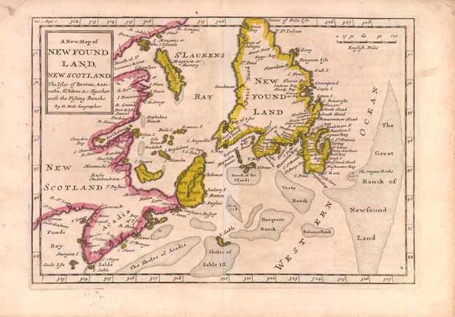
Subject: Canada

Period: 1708 (circa)

Publication: The British Empire in America

Color: Hand Color

Size:
10.3 x 7.3 inches
26.2 x 18.5 cm
Download High Resolution Image
(or just click on image to launch the Zoom viewer)

This is the first state of Moll's map of the Gulf of St. Lawrence, which was first published in The British Empire in America in 1708, and subsequently in two other publications through 1717. This map appears to be based on Thornton's two maps of 1676 and 1689, in which Acadia has a triangular shape and Newfoundland has a truncated top. The map shows particularly good detail of the fishing banks and coastlines.

References: Kershaw #563.

Condition: B+

Toned with very faint offsetting.

Estimate: $160 - $200

Sold for: $180

Closed on 9/14/2011

Archived