Subject: North America
Period: 1708 (dated)
Publication:
Color: Hand Color
Size:
23 x 17.4 inches
58.4 x 44.2 cm
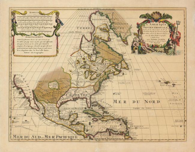
This is Schenk's version of Delisle's foundation map of North America. It is nearly identical to the Delisle map, with California returned to its peninsular position rather than as an island. Cape Mendocino is the farthest northern point in California, and the north portion of the continent is left blank. The Great Lakes are well-defined, based on Coronelli, with French forts noted. The English settlements are confined east of the Allegheny Mountains, and Spanish forts are clustered around Santa Fe. The Mississippi River valley is well developed with recent French settlements. The first mention of what would be called the Sargasso Sea is noted in the North Atlantic. The map is decorated with an aquatic-themed figural cartouche and a draped scale of miles.
References: Tooley (Amer) p.19, #34; cf Wheat [TMW] #79.
Condition: A
Nice impression with original color that is lightly oxidized. A few minor centerfold repairs on verso.