Subject: North America
Period: 1705 (dated)
Publication: Petit et Nouveau Atlas
Color: Black & White
Size:
11 x 8 inches
27.9 x 20.3 cm
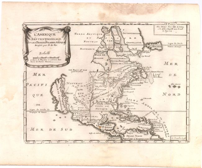
This uncommon map is based on Coronelli's large, two-sheet depiction of the continent from 1692. California is depicted as an island on the second Sanson model with two indented bays in the northern coast. De Fer's map deviates from Coronelli's cartography in a couple of regions; Lake Ontario forms the headwaters of the St. Lawrence River leaving the other Great Lakes landlocked, and Baffin island is shown. The map is small, and thus not heavily detailed, but the eastern coast includes the names of Boston, New York, Providence, Chesapeake Bay, Virginia, Carolina and Florida. The map was initially issued in 1693; this is the second state with the date of 1705 added. The title is displayed on a drape-style cartouche. Engraved by C. Inseln.
References: Burden #696; McLaughlin #111.
Condition: B+
Some damp stains in the margins with a couple tiny spots within the map.