Subject: South Pacific Ocean
Period: 1748 (circa)
Publication:
Color: Hand Color
Size:
12.6 x 10.6 inches
32 x 26.9 cm
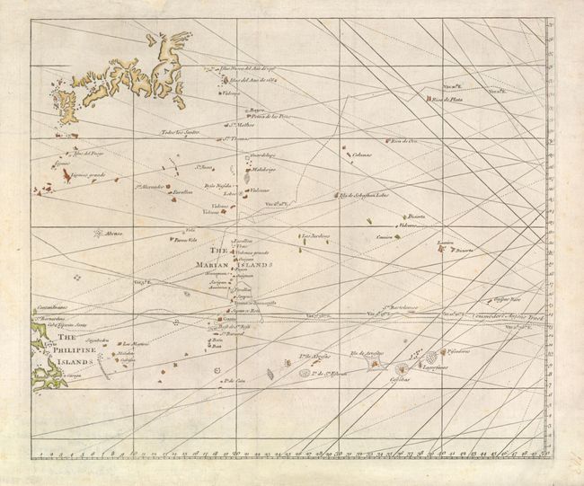
This is the western sheet from this unusual chart that details the route of Spanish galleons from the Philippines through the Mariana Islands on their way to Acapulco along with the track of British Navy Commodore George Anson.
In 1740 Anson set sail in command of a squadron sent to attack Spanish possessions and interests in South America. The expedition was ill-equipped and failed to carry out its original ambitious mission. By June 1741 when Anson reached Juan Fernandes, his force had been reduced to only three of the original six ships, while the strength of his crews had fallen from 961 to 335. After recuperating on the island, he collected the remaining survivors on his flagship, the Centurion, and set sail in search of one of the richly laden galleons that conducted the trade between Mexico and the Philippines. The indomitable perseverance he had shown during one of the most arduous voyages the history of sea adventure gained the reward of the capture of an immensely rich prize, the Nuestra Señora de Cabadonga, which he encountered off Cape Espiritu Santo on June 20, 1743.
References: cf Mercator's World Nov/Dec '98 p. 44.
Condition: A