Catalog Archive
Auction 136, Lot 760

"Karte von den N.W. Amerikanischen und N.OE. Asiatischen Kusten…", Schraembl, Franz Anton

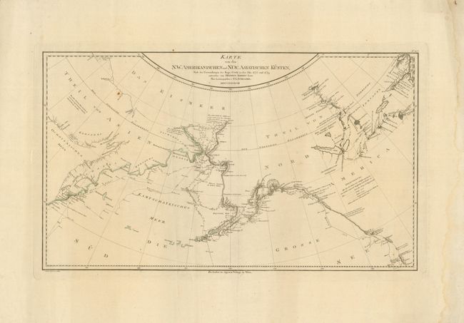
Subject: North Pacific, Northern Asia and Northwestern North America

Period: 1788 (dated)

Publication: Allgemeiner Grosser Atlas

Color: Hand Color

Size:
26.5 x 15.4 inches
67.3 x 39.1 cm
Download High Resolution Image
(or just click on image to launch the Zoom viewer)

Handsome large-scale map of the coastlines of the North Pacific based on the map by Capt. Cook's cartographer, Lieutenant Henry Roberts. It covers the western coast of Alaska and the east coast of Asia including Kamtschaka and illustrates Cook's explorations in 1778 and 1779. Excellent detail in the Bering Straits, including extensive notes on soundings. Notes concerning other explorations in the region are also included both along the coasts and inland. The Schraembl edition of Cook's map is one of the scarcest editions.

References: Kershaw #1149.

Condition: B+

Original outline color with wide margins and damp stain along right-hand edge confined to blank margin. There is a small rust stain in the map.

Estimate: $300 - $375

Sold for: $220

Closed on 6/1/2011

Archived