Subject: Africa
Period: 1597-1790 (circa)
Publication:
Color:
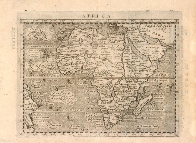
1) Africa, by Magini & Keschedt, from Geographia, 1597 black & white, (6.7 x 4.8"). Small map of Africa and the Arabian Peninsula showing part of Brazil as well. Engraved by Girolamo Porro for Magini's edition of Ptolemy and based on Ortelius. The rivers of central and north Africa feature prominently including the Ptolemaic concept of the origin of the Nile in twin lakes south of the Equator. The largest of these lakes also has a river flowing southeast. The sea is stipple engraved with a tiny sea monster and decorative calligraphy. Latin text on verso. Ref: Betz #35. Condition: Light toning. (B+)
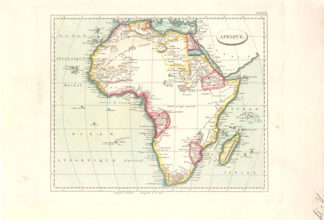
2) Afrique, anon., circa 1840's, hand color, (9.7 x 7.8"). Contrasting with older maps, the interior of Africa is blank, which corresponds to the amount of exploration that was conducted by this time. Condition: Original color with wide margins. (A)
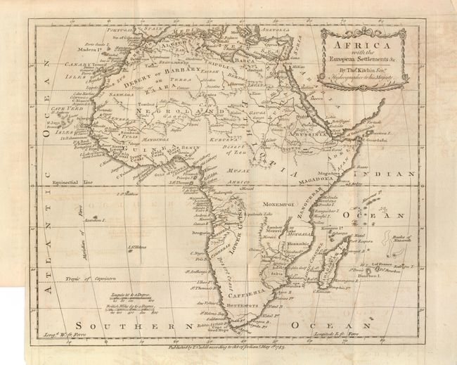
3) Africa with the European Settlements &c., by Thomas Kitchin, dated 1783, black & white, (11.3 x 9.4"). Again, this map shows limited detail in central Africa, focusing on northern Africa and the coastlines. Condition: Issued folding with light toning and offsetting, with the binding trim closed on verso with archival tape. (B)
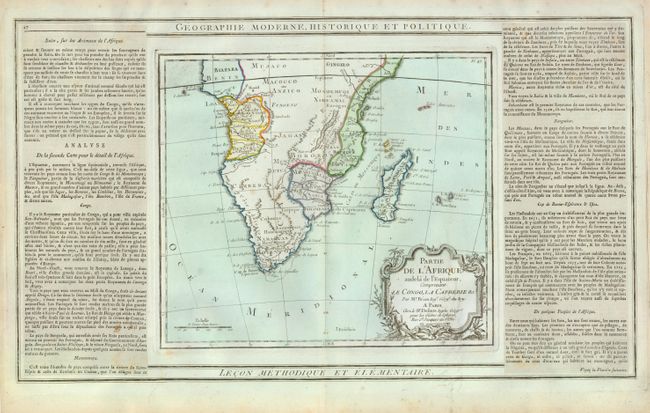
4) Partie de l'Afrique audela de l'Equateur, Comprenant le Congo, la Cafrerie &c., by Brion de la Tour & Louis Charles Desnos, dated 1790, hand color, (10 x 8.8"). The cartographical content of this decorative map of southern Africa is moderately accurate. Hottentot tribes are mentioned and Fort Hollandois is shown at the Cape. The western coast is labeled Cote Deserte with the kingdoms of Benguela, Angola, Congo and Benin delineated. On the east coast several kingdoms are shown including Monomotapa and Zanguebar. Flanked by French text on sheet measuring 19.8 x 12.8". Condition: Centerfold split at top and bottom, not entering map image. A few small, unobtrusive spots in map image. (B+)
References:
Condition:
See description.