Catalog Archive
Auction 136, Lot 707

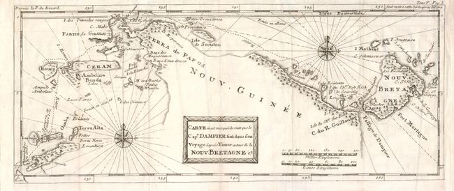
"Carte ou est marquee de route que le Cape. Dampier tint dans son Voyage deouis Timor autour de la Nouv. Bretagne", Dampier, William (Capt.)

Subject: East Indies - Indonesia

Period: 1705 (circa)

Publication:

Color: Black & White

Size:
15.7 x 6.5 inches
39.9 x 16.5 cm
Download High Resolution Image
(or just click on image to launch the Zoom viewer)

This scarce map shows the route of Captain William Dampier's voyage in the HMS Roebuck in 1699 from Timor, through the famous Spice Islands and along the northern coast of Papua New Guinea to New Britain. The first British scientific expedition to the region, it gathered important data on the flora and fauna of Australia and New Guinea.

References:

Condition: B+

With folds as issued. Side margins extended to accommodate framing.

Estimate: $275 - $325

Unsold

Closed on 6/1/2011

Archived