Subject: Japan and Korea
Period: 1636 (circa)
Publication:
Color: Hand Color
Size:
17.4 x 13.4 inches
44.2 x 34 cm
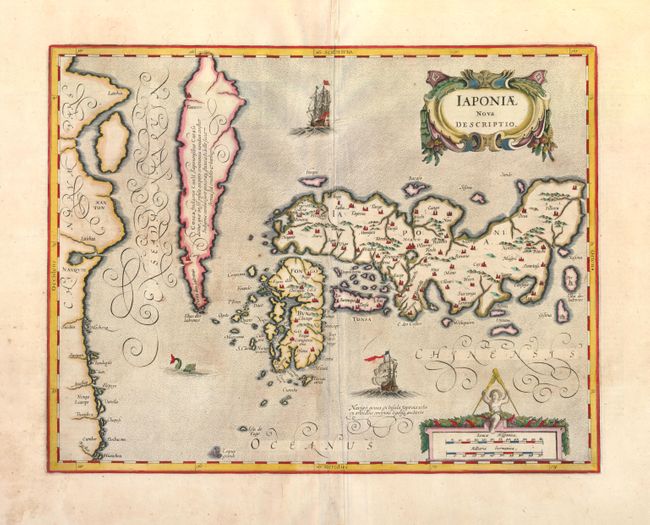
This map of Japan and Korea is presented on the Ortelius/Teixeira model, which had been the standard for mapping the region since Ortelius first published Teixiera's map in 1595. The map shows Korea as an island which tapers to a point and a cluster of islands labeled Ilhas dos Ladrones (islands of thieves). A label on the island notes that it is not known if Korea is an island or a peninsula. Jodocus Hondius engraved the map initially in 1606 with the title simply Iaponia and a Korean junk sailing below Japan. Jansson made his mark on the map, which he re-engraved for his editions of the Mercator Atlas 1636-1649, by changing the title and the ornamental features, including two decorative cartouches, two European ships, and a sea monster. Latin text on verso.
References: Walter #23; OAG #18.
Condition: B+
Wide, original margins with a tiny burn hole just west of <i>Punta dos Landrones</i>. The paper is supple overall, but there are two short cracks along Japan's border in centerfold, caused by the oxidation of the original green pigment, that have been backed with Japanese tissue. There are some repaired tears and chips in blank margins, far from map image.