Catalog Archive
Auction 136, Lot 592

"[Tabula IX Europae]", Ptolemy/Fries
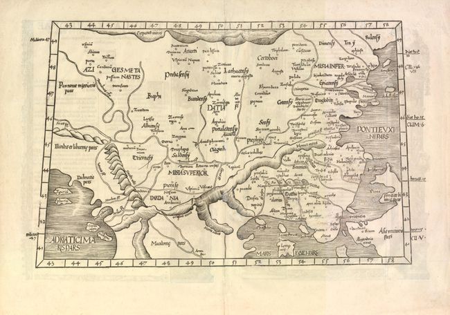
Subject: Balkans

Period: 1535 (published)

Publication:

Color: Black & White

Size:
19.3 x 11.8 inches
49 x 30 cm
Download High Resolution Image
(or just click on image to launch the Zoom viewer)

This is a Ptolemaic map covering the Balkans from the Adriatic to the Black Sea. There are elaborate architectural illustrations on verso completed by Hans Holbein and Graf of Basel. Published by Fries in 1535.

References:

Condition: B

Well preserved map. There are some old brown ink notations in the map that have been partially covered but are still visible.

Estimate: $400 - $475

Sold for: $200

Closed on 6/1/2011

Archived