Subject: France
Period: 1869 (published)
Publication: Atlas National Illustre
Color: Hand Color
Size:
17 x 11.5 inches
43.2 x 29.2 cm
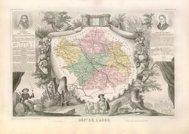
Victor Levasseur's "Atlas National Illustre" and "Atlas Universel Illustre" are among the last decorative atlases published. The maps are all lavishly illustrated with scenes of the countryside, products and activities indigenous to the region.
Dept. de l'Aube. The Aube is the southernmost of the Champagne wine regions. Though overshadowed by the famous names of Rheims and Epernay to the north, this region of Aube en Champagne is - the locals claim - bubbly's true home. It was here that Saint Bernard of Clairvaux first planted the chardonnay and pinot vines more than 700 years ago that are at the heart of the world's greatest vines. Almost half of the Aube harvest goes into the bottles bearing the famous labels of Mumm, Piper-Heidsieck and Laurent- Perrier. The vineyards of the Côte des Bar south of the town of Troyes form a peak, with Bar-sur-Aube at the top and a line along Bar-sur-Seine and les Riceys at the bottom. At bottom left a hunter celebrates his success with a bottle. A terrific map for the wine connoisseur.
References:
Condition: A
Original color, as issued. Minor soil and edge tears, well away from the map.