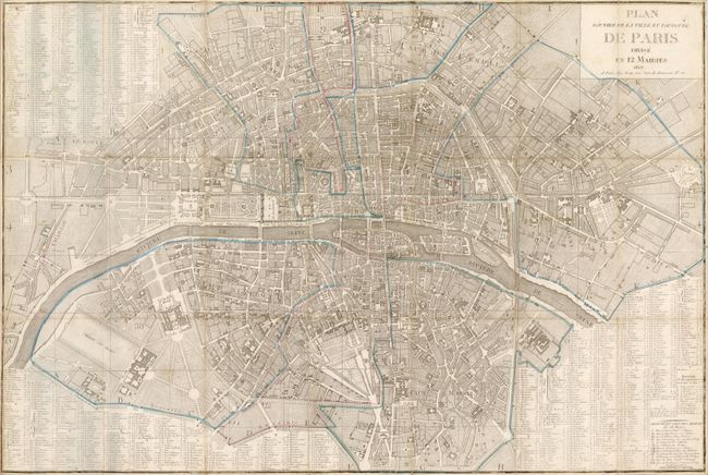
Subject: Paris, France
Period: 1807 (dated)
Publication:
Color: Hand Color
Size:
32.8 x 22 inches
83.3 x 55.9 cm
This folding pocket map shows Paris divided into twelve municipalities (Maires) as reorganized by Napoleon Bonaparte in 1800 following the French Revolution. The original 48 Departments are still numbered. The plan shows the city's center in great detail with all major streets and boulevards located and named. Important buildings are shown in plan view and each is named. The large index locates hundreds of buildings including theatres, hospitals, churches, colleges, etc. The index further names all major streets, keying their location on the map. Published at Rue Jean de Beauvais no. 32.
References:
Condition: B+
The municipalities are delineated in original outline color. The folding map has the original stiff red paper cover attached to one panel, but is missing the front cover. The map has a few small fold intersection splits and very light toning at some edges. Old owner's name in brown ink on verso of front segment.