Subject: France
Period: 1700 (circa)
Publication:
Color: Hand Color
Size:
23.5 x 19.2 inches
59.7 x 48.8 cm
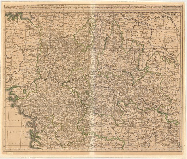
Very strongly engraved map centered on Orleans and Tours. The map extends to the Atlantic at the Bay of Biscay and east to Burgundy. Fortified towns are identified and hundreds of small villages are named. Locates Thiers, Userche, Niort, Nantes, Rennes, Seez, Aux Erre, and many more. Two distance scales at upper right and legend opposite.
References:
Condition: B
Very dark impression and original outline color. On thick, sound paper that was previously framed leaving behind mounting paper on verso at edges and overall toning from framing. The centerfold backstrap protected this region from toning resulting in a lighter area.