Catalog Archive
Auction 136, Lot 513

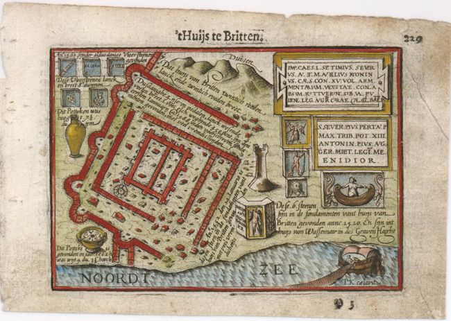
"'T Huijs te Britten", Langenes, Barent

Subject: Netherlands

Period: 1598 (published)

Publication: Caert-Thresoor

Color: Hand Color

Size:
5 x 3.8 inches
12.7 x 9.7 cm
Download High Resolution Image
(or just click on image to launch the Zoom viewer)

This tiny map shows a plan of the Roman ruin of Brittenburg west of Leiden at the mouth of the old river Rhine. It is a reduced version of Ortelius' plan of 1562. Brittenburg was guard post in the Roman border defenses, which formed the northern frontier of the Roman province Germania Inferior. Engraved by Petrus Kaerius, published by Cornelius Claesz and printed by Langenes in the first edition of the popular Map-treasury. Dutch text on verso.

References: King (2nd ed.) pp. 80-82.

Condition: B+

Dark impression with soiled margins.

Estimate: $110 - $150

Sold for: $80

Closed on 6/1/2011

Archived