Catalog Archive
Auction 136, Lot 481

"Improved Map of London for 1833, from Actual Survey", Virtue, George

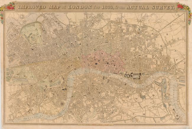
Subject: London, England

Period: 1833 (dated)

Publication:

Color: Hand Color

Size:
25.8 x 16.5 inches
65.5 x 41.9 cm
Download High Resolution Image
(or just click on image to launch the Zoom viewer)

Handsome early 19th century map of central London showing streets, canals, public buildings, docks, bridges and parks. The River Thames is shown in excellent detail flowing through the city from Limehouse Reach to Chelsea Reach. The title is flanked by small garlands of flowers. Engraved by W. Schmollinger and published by George Virtue.

References: Howgego #349.

Condition: B

Fold separations on the left and top portion of the image have been repaired on verso. Light toning and spotting in the image. Issued folded with binding trim replaced at right.

Estimate: $250 - $325

Sold for: $220

Closed on 6/1/2011

Archived