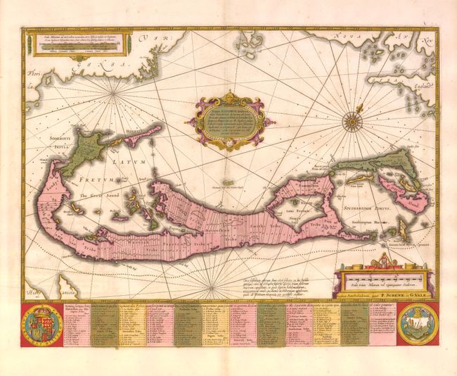
Subject: Bermuda
Period: 1700 (circa)
Publication:
Color: Hand Color
Size:
20 x 15.3 inches
50.8 x 38.9 cm
A striking map based on the famous survey by Richard Norwood of the Bermuda Company, also known as the Somers Isles Company in 1618. The map shows the division into the original Tribes, which were a short-lived name for what became administrative parishes, and were names of major shareholders in the company. Also shown are the various landowners, with their names in a table below the map. There are many tiny houses shown on the map, locating settlements, as well as minute cannons marking the defensible points. The map is superimposed over a chart of the Atlantic with the coastlines of Britain, North America and Hispaniola showing the location of Bermuda. Decorated with an exquisite strapwork cartouche, a coat of arms, a medallion and a compass rose. Jansson reissued Hondius' plate with his imprint between 1647 and 1666. This is Valck & Schenk's reissue of Jansson's map, with their publisher's imprint replacing Jansson's.
References: Palmer (MCC-19) #11.
Condition: A
Original color with a few hairline cracks in green areas professionally repaired on verso.