Subject: South America - Central
Period: 1756-1760 (circa)
Publication: Histoire Generale des Voyages
Color: Hand Color
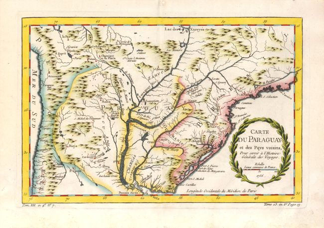
1)Carte du Paraguay et des Pays Voisins, 1756, (12.2 x 8"). Detailed chart covering the region of northern Argentina with Paraguay, Uruguay, southern Brazil and part of Bolivia and Chile. The mythical Lac des Xareyes is shown as the source of the La Plata River at the top of the map, and Buenos Aires is shown at the bottom. The title is contained within a garland style cartouche. A+ condition.
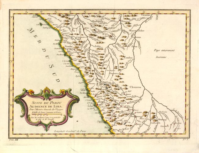
2)Suite du Perou Audience de Lima, ca. 1760, (11.5 x 8.2"). Copper engraved map covering the northern two-thirds of Peru. The map shows Pisco near the bottom and extends north to above 6° S. latitude. Names Lima, Cuzco, Abancay, Guamanga, Guamuco, Cambas, Yurimanguas, Naranjos, Moyobamba, and more. Nice detail of smaller towns, mountain ranges, and rivers. Large decorative title cartouche in rococo-style. A condition.
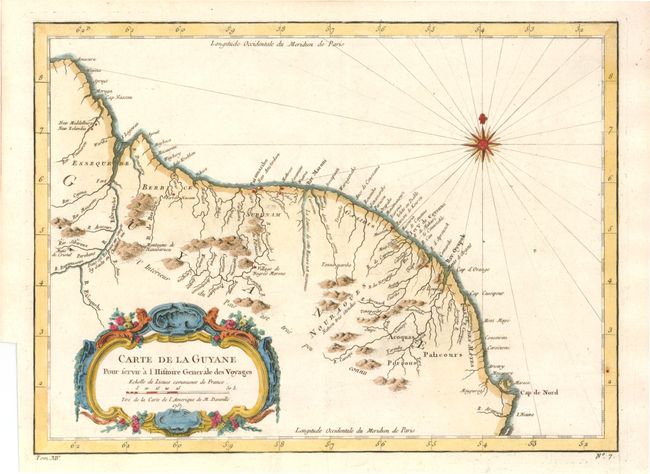
3)Carte de la Guyane, 1757, (12.5 x 9.3"). Decorative map of the coastal region from Amacura to Cap de Nord. The map is based on the work of the great French cartographer D'Anville. Nicely detailed and adorned with a compass rose and a large title cartouche. A condition - binder's tear in lower left margin.
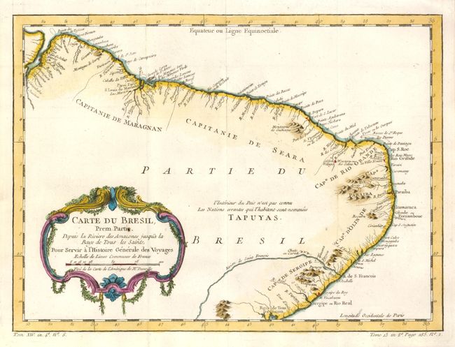
4)Carte du Bresil Prem. Partie Depuis la Riviere des Amazones jusqu'a la Bay de Tous les Saints, ca. 1756, (12.7 x 9.3"). This finely engraved map covers from the mouth of the Amazon to Baía de Todos os Santos. Only coastal detail is shown with regions divided into the Capitaineries or hereditary harbor offices. The interior region is noted as being unknown and the domain of the Tapuyas Indian nation. A condition.
References:
Condition:
See descriptions.