Subject: Venezuela
Period: 1690 (circa)
Publication:
Color: Hand Color
Size:
19.8 x 16 inches
50.3 x 40.6 cm
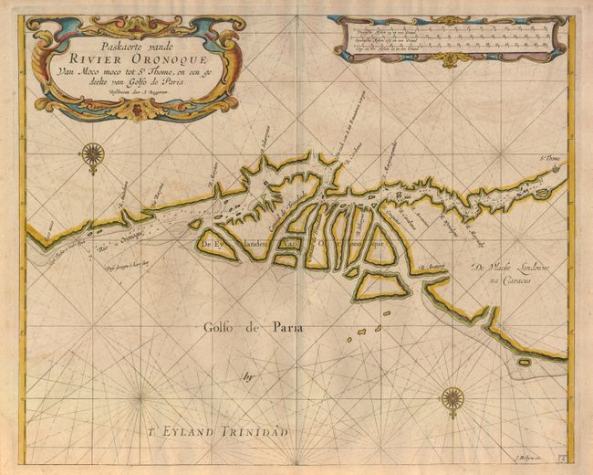
This is a very rare Dutch sea chart of the Gulf of Paria, focusing on the entrance to the Orinoco River. The region depicted was contested between the English and Dutch during the 17th century as both colonial powers attempted to establish tobacco and sugar plantations. Two fine compass roses orient the chart with north on the bottom and strapwork cartouches complete the adornment.
Arent Roggeveen, a land surveyor and mathematician, taught navigation for the Dutch East and West India Companies. He also helped maintain their collection of hydrographic manuscripts and charts. In the mid 1660s, Roggeveen compiled a series of large-scale sea charts of North America and the West Indies, which was published by Pieter Goos in Het Brandende Veen or The Burning Fen. This landmark atlas was the first Dutch pilot to focus on the Americas, with a number of regions mapped in larger scale than in any previously printed work. Roggeveen died in 1679 and Goos' widow sold the plates to Jacob Robijn, who reissued the maps in 1680.
Both editions are extremely rare. This example is Robjin's, who has removed the island of Trinidad and revised the Venezuelan coastline from Roggeveen's plate. Romjin's signature is in the lower-right corner.
References:
Condition: B+
Small binding stitch in upper portion of the image and very light offsetting.