Catalog Archive
Auction 136, Lot 404

"L'Isle St. Domingue ou Espagnole Decouverte l'An 1492. Par les Espagnols…", Fer, Nicolas de
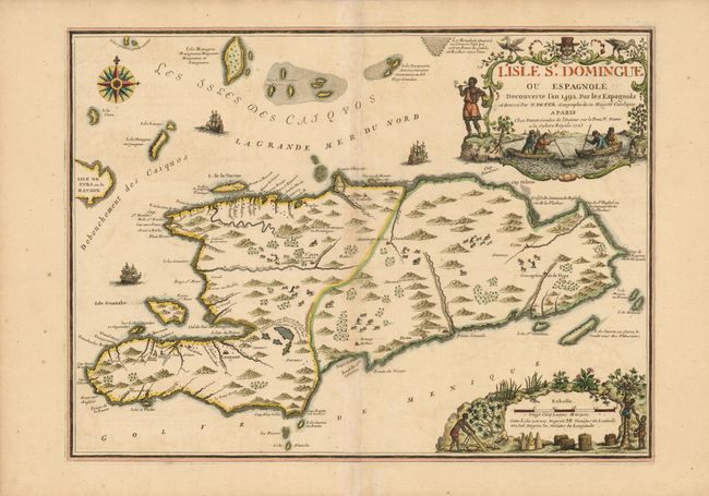
Subject: Hispaniola

Period: 1723 (dated)

Publication:

Color: Hand Color

Size:
23.2 x 17.2 inches
58.9 x 43.7 cm
Download High Resolution Image
(or just click on image to launch the Zoom viewer)

Map of Hispaniola and the Turks & Caicos Islands. Hispaniola is shown divided into two parts with the French owning the western third of the Island and Spain controlling the rest. These boundaries were based upon the 1697 Treaty of Ryswick. There is interesting detail of mountains, rivers, towns and wildlife. The beautiful title cartouche depicts Columbus’ discovery of the island in 1492 and a distance scale cartouche displays native scenes.

References:

Condition: B+

Minor toning along the centerfold, which has been repaired with tissue on verso. Slight crease to the right of the centerfold.

Estimate: $850 - $1,000

Sold for: $600

Closed on 6/1/2011

Archived