Subject: Gulf of Mexico and Caribbean
Period: 1768 (circa)
Publication: The Chronology and History of the World
Color: Hand Color
Size:
22.6 x 16.3 inches
57.4 x 41.4 cm
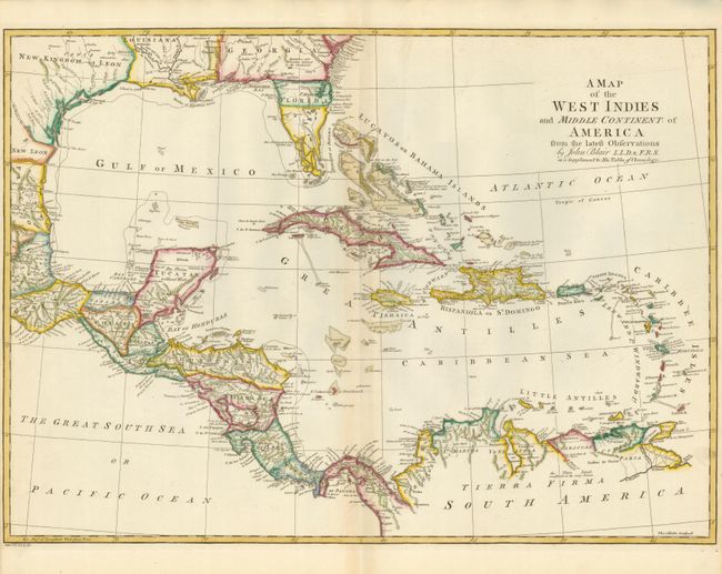
This boldly engraved chart of the Gulf of Mexico and the Caribbean is filled with interesting information, with many forts and towns named. The British colony of Georgia extends to Mobile Bay and its boundary with Florida is noted as Limits Stipulated 1738, leaving the Spanish colony of Florida occupying only the peninsula. A line further south is noted as the Southern Bounds [Georgia] by Charter 1665. The southern portion of Florida is shown as a jumble of large islands, named Bay del Spiritu Santo. Texas is named as the New Kingdom of Leon. The map was engraved by Thomas Kitchin.
References:
Condition: B+
Sharp impression on watermarked paper. Faint toning along the centerfold. Clean tear barely entering the map in the lower-left hand side repaired on verso with archival tape. Narrow side margins as issued.