Subject: Mexico
Period: 1579-1754 (dated)
Publication:
Color:
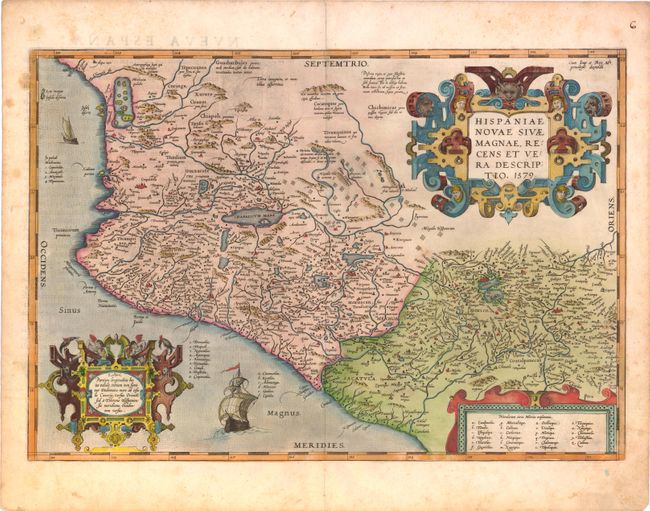
1) Hispaniae Novae sivae Magnae, Recens et Vera Descriptio, by Abraham Ortelius, from Theatrum Orbis Terrarum, hand colored, 19.7 x 13.6". Important map of the central and western coastal regions of Mexico. This is a cornerstone map of New Spain and the prototype for most maps of the early 17th century. It covers the Pacific coast from present-day Acapulco to about Mazatlan and inland to Mexico City, which is situated on a large lake. Several gold and silver mines are located in the central region. The map is beautifully embellished with three fine strapwork cartouches and two Spanish galleons. Spanish text and page number 6 on verso indicates it was published in the 1588 edition. Fine original color and strong impression with full margins. Some scattered foxing in margins.
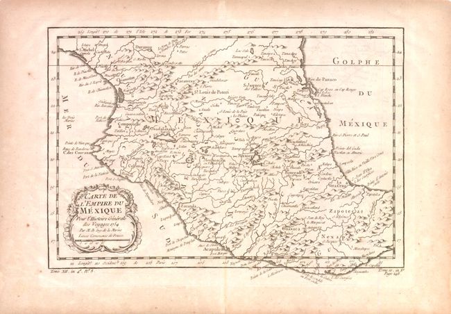
2) Carte de l'Empire du Mexique by Jacques Nicolas Bellin, from Prevost's Histoire Generale des Voyages, 1754, black & white, 11.5 x 8.3". This is a finely engraved map of central Mexico that reaches from Durango and Tamaclipa in the north to Mexaltepec and the Isthmus of Tehuantepec in the south. Mexico City is located on the shores of a large lake. Decorative rococo-style title cartouche with a distance scale below the title. Longitude is from Paris on the lower scale and the Isle de Fer on the upper. Fine impression on a full sheet with wide margins and watermark. Some light scattered foxing or toning more in margins.
References: 1) Wagner #119, Van den Broecke #13.
Condition: B+
See individual descriptions.