Subject: United States, Texas & Mexico
Period: 1844-46 (circa)
Publication:
Color: Hand Color
Size:
12 x 8.8 inches
30.5 x 22.4 cm
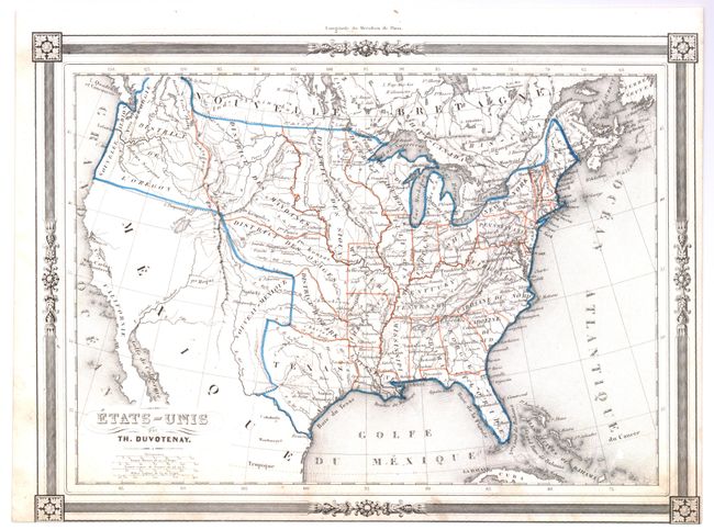
A matched pair of maps that share the same decorative borders with graphic elements in each corner and four distance scales. The first map shows Mexico encompassing the majority of the Southwest and California. Texas is shown as an independent Republic. Most of the states east of the Mississippi River are named and outlined, except for Wisconsin, which is called District Huron. Besides Missouri, Arkansas, Louisiana, and Texas, land west of the Mississippi River is separated into regions, including District of the Mandanes, District of the Osages, District of the Ozark, District of the Sioux, and District of the Oregon. Canada is called Nouvelle Bretagne. Very nice example. The lower margin is close, apparently as issued. (A)
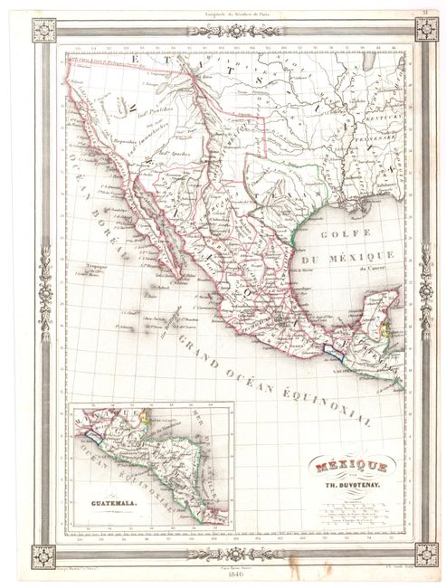
The second map is centered on Mexico and the Southwest showing the Republic of Texas. It contains pre-Mexican/American War geography apart from the addition of a dashed line denoting the new territorial limits of the United States. The inset "Guatemala" shows most of Central America through Costa Rica, all labeled Guatemala. The region along the California coast is called Nouvelle Californie and the Baja is Ancienne Californie. This map is dated 1846, but the geography shown is a few years earlier. Short printer's crease across Gulf of Mexico, marginal tear at left, expertly closed and a small brown stain in lower margin just into border. (B+) Together they are a nice set of matched maps, both showing the Republic of Texas.
References:
Condition:
See individual descriptions.