Subject: World
Period: 1841 (dated)
Publication:
Color: Black & White
Size:
24 x 15.5 inches
61 x 39.4 cm
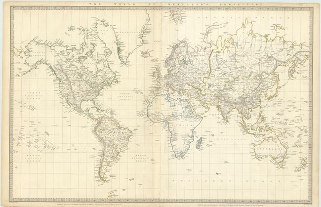
This delicately detailed map presents a considerable amount of information. The United States is shown excluding the Southwest and Texas. Texas was an independent country from 1836-1845, but it is shown here as part of Mexico. The northern border of the United States and Canada shows the disputed border for Oregon Territory coming down to about the 45th parallel at the Columbia River, which reflects British claims in that region. This was finally solved in 1846 with the border at the 49th parallel. The Arctic region shows the extent of contemporary knowledge, noting nothing besides Packed Ice north of the Bering Strait. Africa is shown with much of its interior left unmapped - that region was not mapped thoroughly until the latter part of the 19th century. An attractive and informative map surrounded with a keyboard style border.
References:
Condition: B+
Some faint toning primarily in the margins and light discoloration on centerfold.