Subject: Texas
Period: 1857 (circa)
Publication: General Atlas
Color: Hand Color
Size:
26 x 17 inches
66 x 43.2 cm
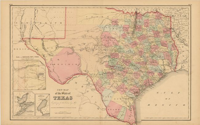
This handsome Texas map is based on an important 1849 map by Jacob de Cordova, which was the first to be drawn from General Land Office records. It shows extensive detail throughout the settled part of the state. The western third is comprised of the large unsettled areas of Presidio, El Paso, Bexar and the Staked Plain. Cooke County in the northern part of the state is oversized and extends well into the Staked Plain. The other county development is consistent with 1855-56 and the plain border suggest this was published circa 1857. Railroads, forts, post offices, roads, springs, and topographical detail are all clearly indicated. Three insets show the panhandle, Galveston Bay, and Sabine Lake.
References:
Condition: B+
Just a little foxing on lower centerfold and some spots at extreme left, otherwise very good. Full, original margins, fine color and crisp impression.