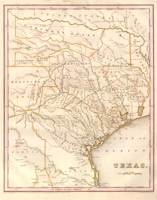
Subject: Republic of Texas
Period: 1838 (published)
Publication: An Illustrated Atlas…
Color: Hand Color
Size:
11.3 x 14.4 inches
28.7 x 36.6 cm
Early edition of this Independent Republic of Texas map that was patterned on Stephen Austin's seminal map. The map shows the empresario grants, lakes, rivers, creeks, towns and Indian villages. The Old Mexican Garrison is located on the Brazos River north of Deer Creek. The border with Mexico is at the Rio de las Nueces rather than the Rio Grande and the northern boundary is along the Red River. The map locates and names San Antonio de Bexar, San Felipe de Austin, Sabine, St. Augustine, Nacogdoches, Zavala, Tivis, Houston, Montezuma, Waco Village, Tenoxititlan, and more. There are approximately 17 grants named, including Stephen F. Austin, Woodbury & Cos, Cameron's, (two separate parts), Zavalla's and Whelin's. The large region around Austin is called Austin's Colony. Engraved by G.W. Boynton. Complete with two text pages related to the Republic of Texas.
References: Day #32; Phillips (M) p.842; cf Martin & Martin #31.
Condition: B+
Full, original margins with a nice impression and original outline color. A few spots and light water stains in margins. Oval blind stamp for the Brooklyn Public Library at right margin and 1" into map, with deaccession documentation.