Subject: Charleston, South Carolina
Period: 1776 (dated)
Publication:
Color: Hand Color
Size:
14.6 x 11 inches
37.1 x 27.9 cm
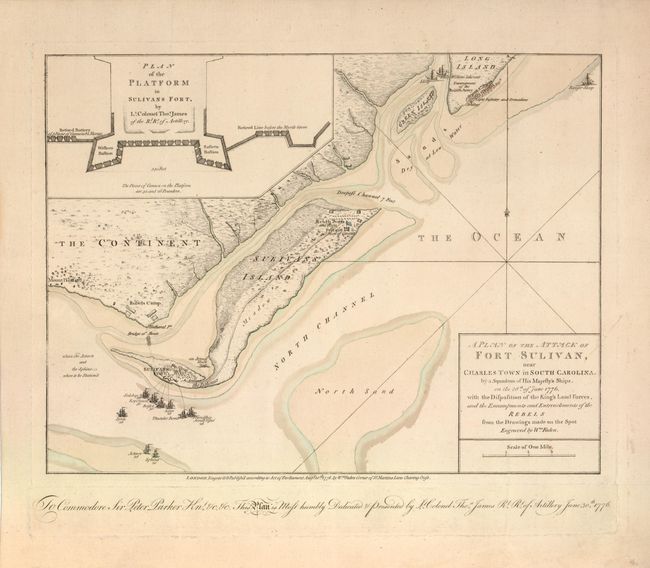
This rare Revolutionary War battle plan depicts a pivotal British naval assault on Fort Sullivan, near Charleston, South Carolina. Charleston was a critical location as it was the largest city and only port in the South. In the summer of 1776, the British dispatched a fleet of ships to regain the possession of Fort Sullivan from the Americans. The map shows the original positions of the British ships, along with their regiment numbers, in the upper-right corner. An inset map depicts the plan of Fort Sullivan. Behind the fort, a makeshift "bridge of boats" connects Sullivan's Island with the mainland and the site of the Rebel's camp. The British ships are illustrated near the fort along with their names and the number of guns on each. Due to tactical errors and misinformation, the British lost the battle despite the fact that they had more than double the manpower and firepower than the Americans. This is the first state of the map, and includes a dedication to Commodore Sir Peter Parker by Lt. Colonel Thos. James.
References: Nebenzahl (Biblio) #64; Tooley (America) p. 60.
Condition: A+
Original color and wide margins, with light toning confined to the blank margins.