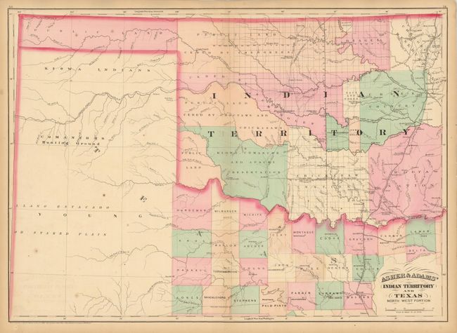
Subject: Oklahoma & Northern Texas
Period: 1874 (dated)
Publication:
Color: Hand Color
Size:
22.8 x 16.3 inches
57.9 x 41.4 cm
This map shows lands ceded to numerous Indian Tribes and was intended as a railroad map of Indian Territory. The Missouri-Kansas-Texas Railroad runs north-south along the eastern border of Indian Territory, and was the first railroad to enter Texas from the north, reaching Dallas by 1886. The proposed route for the Texas Pacific Railroad is also shown, which was intended to extend between Marshall, TX and San Diego, CA, but instead was connected with the Southern Pacific Railroad at Sierra Blanca, Texas in 1881.
References:
Condition: B
Original hand color with a few unobtrusive spots. Centerfold split and a small adjacent tear in bottom margin, neither entering map image.