Catalog Archive
Auction 136, Lot 324

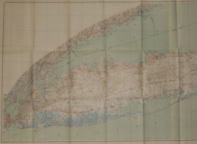
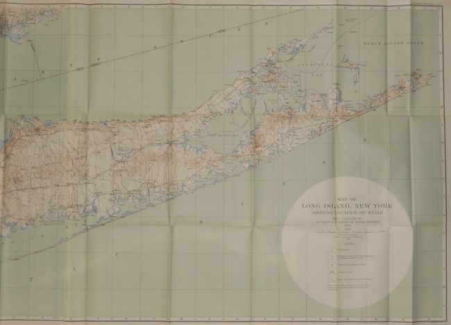
"Map of Long Island, New York Showing Location of Wells…", U.S. Geographical Survey

Subject: New York City, New York

Period: 1903 (dated)

Publication: Professional Paper No. 44

Color: Printed Color

Size:
25.5 x 61.5 inches
64.8 x 156.2 cm
Download High Resolution Image
(or just click on image to launch the Zoom viewer)

An excellent topographical map of Long Island that is filled with details and information. It shows well locations, waterworks pumping stations, groups of wells and lines of tunnels, etc. The colorful map with great detail on a scale of 1 inch = 2 miles and contour intervals at 20 feet. Includes the continental coastline to beyond Bridgeport, Connecticut. This is Plate XXIV from Professional Paper No. 44. Printed by the Julius Bien firm of New York. A stunning example.

References:

Condition: A+

Virtually flawless example which is remarkable considering its size and paper from this period.

Estimate: $200 - $250

Sold for: $210

Closed on 6/1/2011

Archived