Catalog Archive
Auction 136, Lot 313

"The Country between Crown Point and Albany being the Great Pass from the English to the French Settlements in North America", Anon.
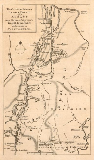
Subject: New York

Period: 1758 (published)

Publication: Grand Magazine of Magazines

Color: Black & White

Size:
4.5 x 7.5 inches
11.4 x 19.1 cm
Download High Resolution Image
(or just click on image to launch the Zoom viewer)

Detailed little map of the Hudson River and the lakes George and Champlain that shows the wagon roads, forts, and settlements in the region. Published in August of 1758 during the French and Indian War, the map was designed to illustrate the recent unsuccessful attempt to dislodge the French from Fort Ticonderoga on Lake Champlain. Also delineates Indian paths and shows a large body of Drown'd Lands along Wood Creek to the south of Fort Ticonderoga. This map is similar to those published in other British magazines of the period. Published in the rare Grand Magazine of Magazines, which ceased publication after less than two years.

References: Jolly GMOM-7.

Condition: A

Clean bright example with exceptionally strong, early impression. Small binding hole in right margin.

Estimate: $200 - $275

Sold for: $190

Closed on 6/1/2011

Archived