Catalog Archive
Auction 136, Lot 285

"[Lot of 2] Map of the State of North Dakota [and] Map of the State of South Dakota", General Land Office

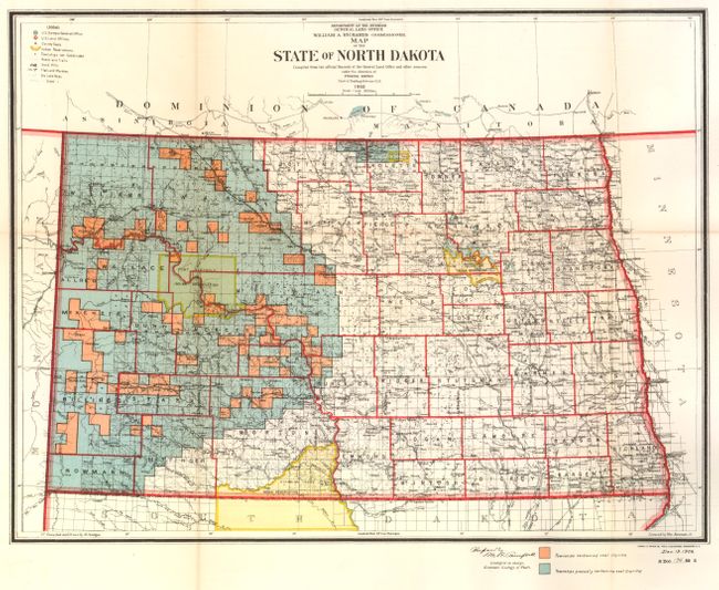
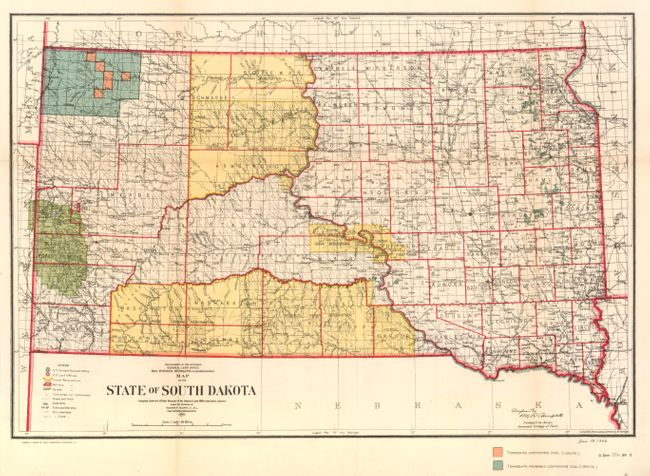
Subject: North and South Dakota

Period: 1906 (dated)

Publication: Dept. of the Interior

Color: Printed Color

Size:
17.15 x 13 inches
43.6 x 33 cm
Download High Resolution Image
(or just click on image to launch the Zoom viewer)

Very detailed maps colored to indicate townships containing and those "probably containing" lignite coal. Both maps were compiled and drawn by M. Hendges, and both signed in the plate by the "Geologist in charge, Economic Geology of Fuels." A historical pair that illustrated the search for coal to satisfy the growing energy requirements of the US economy.

References:

Condition: A

Both with faint fold toning and browning on verso. Both professionally backed with archival tissue.

Estimate: $100 - $140

Unsold

Closed on 6/1/2011

Archived