Catalog Archive
Auction 136, Lot 282

"Topographical Map of the District of Columbia and a Portion of Virginia", U.S. Corps of Engineers

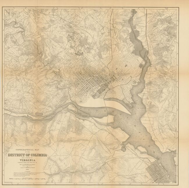
Subject: Washington, D.C.

Period: 1884 (dated)

Publication:

Color: Black & White

Size:
20.5 x 20.6 inches
52.1 x 52.3 cm
Download High Resolution Image
(or just click on image to launch the Zoom viewer)

This incredibly detailed map covers the vicinity of Washington DC including Alexandria, Virginia. It was compiled from maps made by the U.S. Coast and Geodetic Survey 1879-84, military maps made in 1861-65, Boschke's map of 1861 and Carpenter's Assessment maps from 1882.

References:

Condition: A

Folding as issued with minor toning and a couple tiny separations at fold intersections.

Estimate: $100 - $130

Sold for: $110

Closed on 6/1/2011

Archived