Subject: Yosemite, California
Period: 1883 (circa)
Publication:
Color: Printed Color
Size:
21.2 x 14.5 inches
53.8 x 36.8 cm
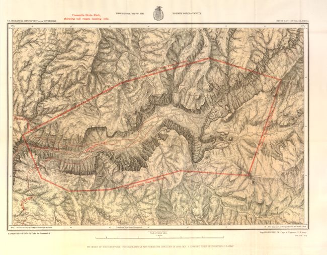
This fine map illustrates in great detail the early development of Yosemite valley when the region was a California State Park. This is a product of Capt. G.M. Wheeler's Expeditions of 1878-79 with the U.S. Geographic Surveys West of the 100th Meridian. It depicts the state park boundaries and the toll roads leading to the park. It also locates early camp facilities, trails, and Indian settlements. Salient geographic features are identified in considerable detail. The skillful rendering of the topography has created a remarkably strong graphic image of this picturesque valley. Mountain drawings by J.E. Weyss, lettering by M. Franke, from the topographical plat by Lt. Macomb, Nov. 30, 1883.
References:
Condition: A+
Folding as issued.