Subject: Western United States
Period: 1854-55 (dated)
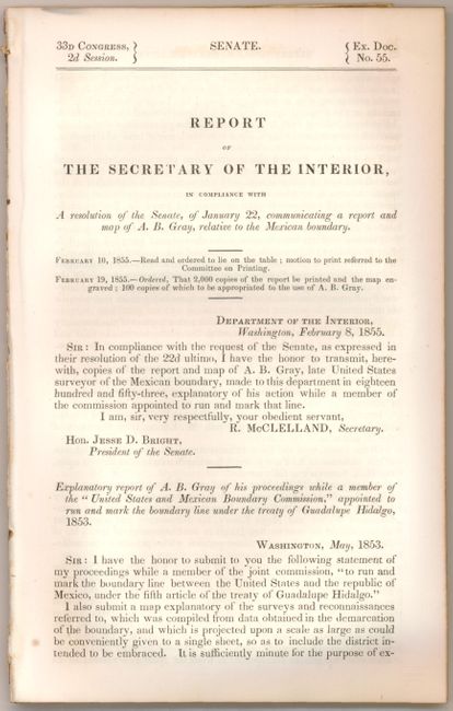
Publication: 33rd Congress, 2nd Session, Senate Exec. Doc No. 55
Color: Black & White
Size:
48.5 x 21 inches
123.2 x 53.3 cm
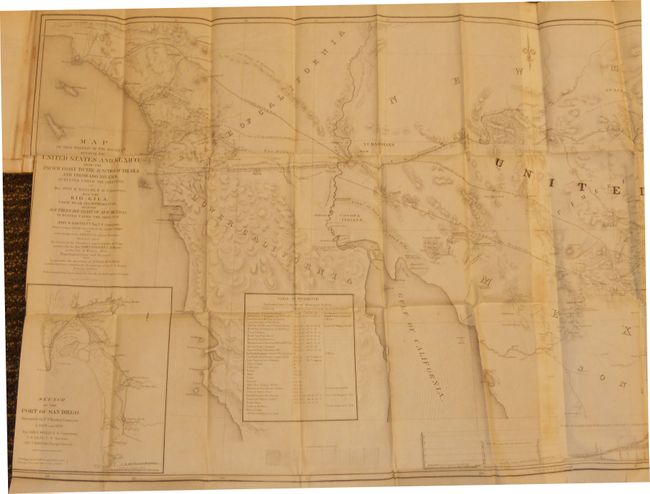
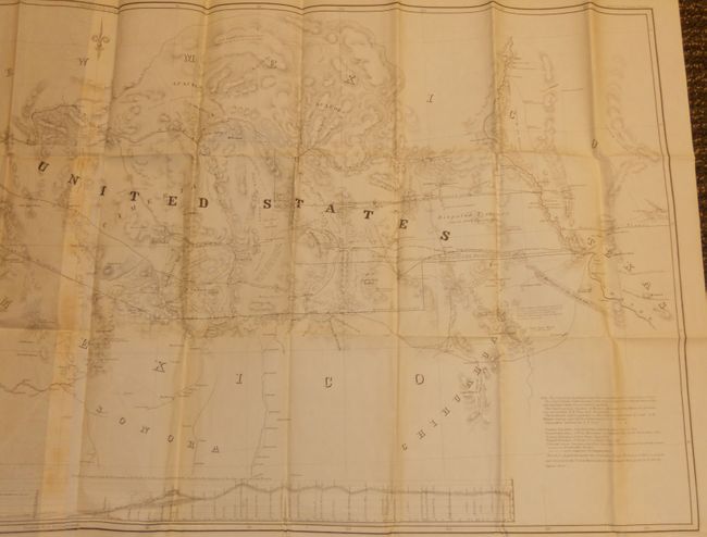
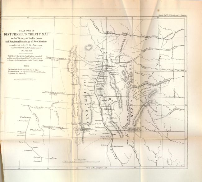
This map and report are the final documentation of the boundary between the United States and Mexico. This historic and informative map shows the territory acquired under the treaty by Gadsden in 1854. It covers the region between the 30th and 34th parallels and extends from Los Angeles to El Paso. The map also delineates two disputed boundaries, namely "Messrs Bartlett and Counde's Line for Southern Boundary of New Mexico…" and "Boundary of New Mexico marked on the Treaty Map (Disturnell) about 8 miles North of El Paso". Insets of "Sketch of the Port of San Diego, surveyed by U.S. Boundary Commission in 1849 and 1850", "Table of Reference. Latitudes and Longitudes of Principal Points" and "Profile of Country from the Rio Grande to the Gulf of California; and from Rio Grande to the junction of the Gila and Colorado Rivers." A remarkable and very large cornerstone map of this important boundary treaty. Still bound with the original, disbound, 50 page report that also includes That Part of Disturnell's Treaty Map in the Vicinity of the Rio Grand and Southern Boundary of New Mexico, which further illustrates the disputed region.
References: Wheat (TMW) #840.
Condition: B+
Folding as issued with very minimal toning on a few folds and a short repaired binding tear in the border.