Catalog Archive
Auction 136, Lot 236

"Karte zur Ubersicht der Neuesten Forschungen Im Innern Nord-Amerika's bis zum ostrande der Rocky Mts.", Petermann, Augustus Herman

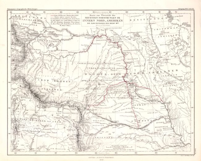
Subject: United States - Central Midwest

Period: 1858 (dated)

Publication: Geographische Mittheilungen

Color: Hand Color

Size:
9.6 x 7.5 inches
24.4 x 19.1 cm
Download High Resolution Image
(or just click on image to launch the Zoom viewer)

Very attractive and finely engraved map showing Lt. G.K. Warren's routes in 1855 and 1856. Warren's tracks are highlighted as they traverse the Northern Plains between the Missouri River and the Rockies. The map extends to the Wasatch Mountains and the Green River in the southwest and the Chippeway Indian land and Rainy Lake in the northeast. It locates numerous forts and Indian lands. Watershed and topographical details include the elevations of river basins, plains and countless mountain peaks.

References:

Condition: A+

Finely engraved map with original outline color. Minute pinhole near "Ogalala-Dakotas."

Estimate: $140 - $180

Sold for: $130

Closed on 6/1/2011

Archived