Catalog Archive
Auction 136, Lot 233

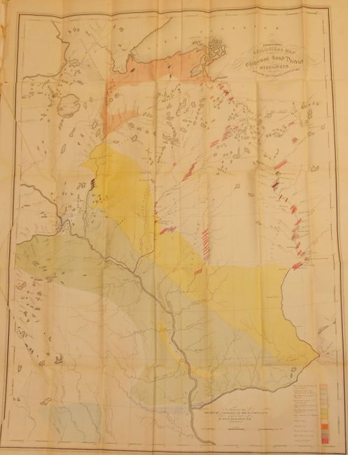
"Provisional Geological Map of Part of the Chippeway Land District of Wisconsin with Part of Iowa & of Minnesota Territory [with report] Report of a Geological Reconnaissance of the Chippewa land district of Wisconsin, and the northern part of Iowa", Owen, David Dale

Subject: United States - Central & Upper Midwest

Period: 1848 (circa)

Publication: Report of a Geological Reconnaissance

Color: Hand Color

Size:
25 x 33.8 inches
63.5 x 85.9 cm
Download High Resolution Image
(or just click on image to launch the Zoom viewer)

An early geological survey of the area from Prairie du Chien (here also Fort Crawford and Kipy Saging) and north along the Mississippi River to the Minneapolis area and beyond to Duluth. The eastern range includes the rapids along the northern reaches of the Wisconsin River. A legend in the lower right explains the use of color to indicate the twelve different geological formations. This scarce map was prepared to illustrate David D. Owen's report on his geological reconnaissance. Owen and his staff are reported to have worked 12-15 hours every day during the summer and winter of 1847 for this notable survey. The map is still attached to the unbound 133-page report, 23 tinted lithograph plates and 14 sections.

References:

Condition: B+

Folding as issued with some toning and creasing. A short binding tear in left margin is closed on verso with archival tape. Some light scattered foxing on plates.

Estimate: $275 - $350

Sold for: $200

Closed on 6/1/2011

Archived