Catalog Archive
Auction 136, Lot 231

Map of the disputed boundary between Michigan and Wisconsin

"General Map to Accompany the Report of Capt. T.J. Cram, T.E., on the Survey of the Boundary between Michigan and Wiskonsin…", Cram, Thomas Jefferson (Capt.)

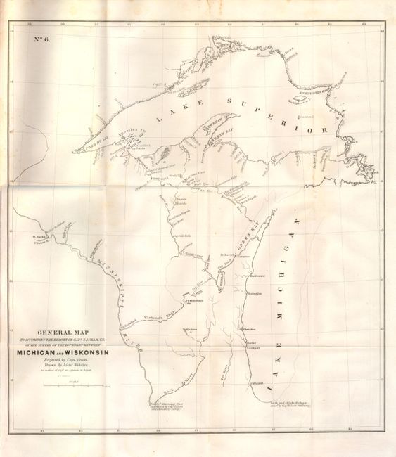
Subject: Midwest, Wisconsin & Michigan

Period: 1842 (published)

Publication:

Color: Black & White

Size:
16.8 x 18.3 inches
42.7 x 46.5 cm
Download High Resolution Image
(or just click on image to launch the Zoom viewer)

This important map and accompanying 12 page Senate report documents Capt. Cram's second survey of the disputed boundary between the Upper Peninsula of Michigan and Wisconsin. The map clearly depicts the lands between the headwaters of the Menominee and Montreal rivers and a survey of both rivers. It also shows the lower part of the Menominee river and ship channels in Green Bay, which were not surveyed due to a lack of funds. This region remained in dispute for well over a century. Click here for William C. Rohde's treatise on the Wisconsin-Upper Michigan State Boundary Surveys.

References:

Condition: A

Folding and still attached to the report with faint toning at the folds.

Estimate: $150 - $200

Sold for: $100

Closed on 6/1/2011

Archived