Subject: United States - Southern
Period: 1831 (dated)
Publication: A New American Atlas
Color: Hand Color
Size:
21.5 x 17 inches
54.6 x 43.2 cm
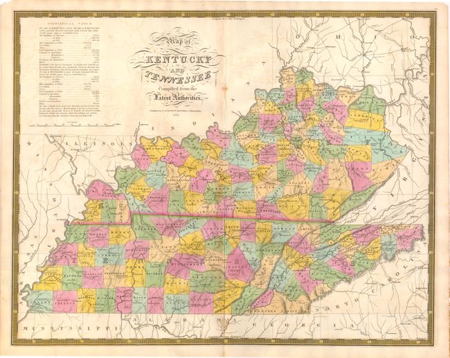
This map of Kentucky and Tennessee is from Mitchell's first cartographic publication, A New American Atlas, which was a reprint of Anthony Finley's atlas published in 1826. The plates for the atlas were drawn by D.H. Vance and engraved by J.H. Young. Mitchell made several changes from the previous publication, including removing Vance's name and adding his own imprint and a decorative border. The table gives 1820 population statistics divided into White, Free Blacks, and Slaves, and population growth figures from 1790 to 1820. The map shows well-developed county lines with the recent founding of Anderson and Hancock counties in Kentucky, and Fayette, Haywood and McNairy counties in Tennessee.
References: Ristow, p. 303-304.
Condition: B+
Original hand color with light toning along the centerfold and a centerfold split at top and bottom that has been repaired on verso with archival tape. Small stain to the right of the title.