Subject: United States - Mid-Atlantic
Period: 1832 (dated)
Publication:
Color: Hand Color
Size:
22 x 16.8 inches
55.9 x 42.7 cm
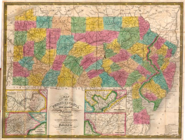
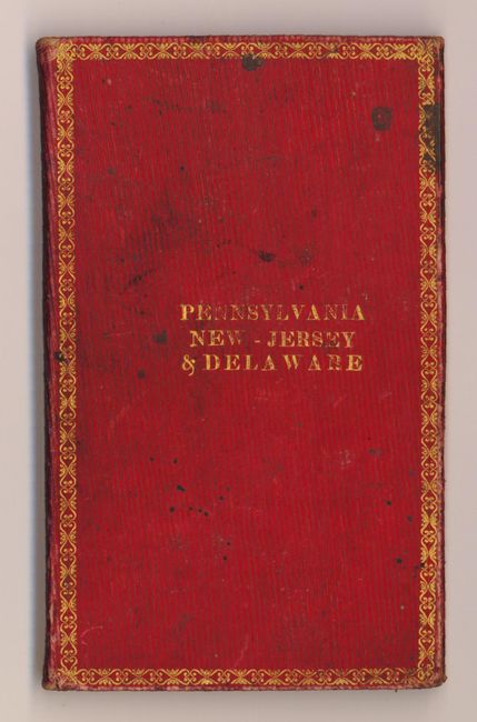
This is probably the first edition of Mitchell's finely engraved pocket map of Pennsylvania. This map is the same size and looks identical his first edition atlas map of 1831 except with the addition of four insets: the Lehigh and Schuylkill Coal Regions, Vicinity of Philadelphia, Vicinity of Pittsburg and Vicinity of Lancaster. There are many roads, towns, railroads and topographical features noted, typical of these wonderfully detailed maps. Original published by Finley; Mitchell purchased his plates in 1831and issued them under his own name. This is a very early issue with Mitchell's imprint and an attractive keyboard-style border. Printed on fine banknote paper and folding into original red leather, gilt-stamped boards measuring 3" x 5". Paper label inside the front cover gives the census figures of 1830 for Pennsylvania, New Jersey and Delaware.
References:
Condition: B+
The map is generally clean and bright with wonderful original color and a couple of small spots and light offsetting. A tiny tear at binding point is closed with archival tape. The boards are very good with only slight wear and a few spots on the inner paper label.