Subject: Maryland and Delaware
Period: 1824 (dated)
Publication:
Color: Black & White
Size:
10.5 x 8.8 inches
26.7 x 22.4 cm
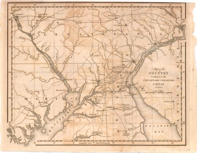
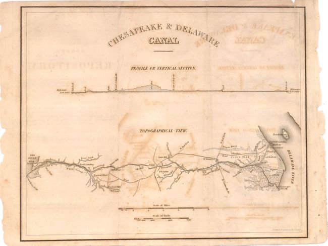
The two maps are complete with the original Fifth General Report of the President and Directors of the Chesapeake & Delaware Canal Company, Mathew Carey, Chairman. The two maps are early productions by Henry Tanner. The first covers the region between Baltimore and Philadelphia. The proposed canal is clearly delineated. The second map has a Topographical View that presents a very detailed plan of the canal between the confluence of Back Creek with Elk River across to the Delaware River at a point near Fort Delaware. The canal was envisioned by regional business leaders, including Benjamin Franklin and Benjamin Rush. When it was finished in 1829 the canal reduced, by nearly 300 miles, the water routes between Philadelphia and Baltimore.
References:
Condition: B
Both maps have offsetting but the paper is sound. The disbound report is generally clean, but there is a tear on the back page partially closed with archival tape.