Subject: Colonial Mid-Atlantic
Period: 1757 (circa)
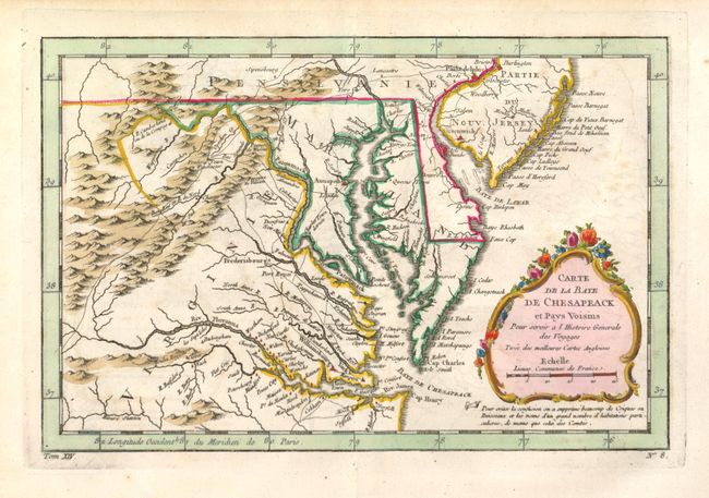
Publication: l' Histoire Generale des Voyages
Color: Hand Color
Size:
11.4 x 7.5 inches
29 x 19.1 cm
Finely engraved colonial map covering most of Virginia, Maryland, Delaware with a bit of Pennsylvania and New Jersey. The interior is fully engraved with mountains and great detail along the rivers. An early network of trails and wagon roads are delineated, plus watershed and some topographical information. It extends west to beyond Fort Cumberland and locates Annapolis, Fredericksburg, Williamsburg, Norfolk, and Philadelphia. The delicate rococo-style title cartouche incorporates the distance scale.
References: Sellers & Van Ee #1383; cf. Tooley (MCC 96) #875
Condition: B+
Dark impression that is slightly blurred with nice color. There is a paper flaw in the bottom margin. Wide, original margins.